View unanswered posts | View active topics It is currently April 19th, 2024, 1:55 am


Reply to topic  [ 14 posts ]  Go to page 1, 2  Next
 Following the route 
Author Message
Firing on two.
User avatar

Joined: May 3rd, 2009, 9:26 am
Posts: 107
Post Following the route
I am working on some kind of a road- book and you will get the possibility to get maps on paper.
However maps of Morocco aren't that precise and you will be going off road and in this case road maps are of no use.

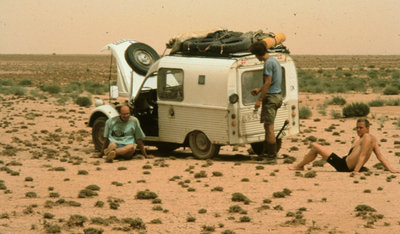
Once on a two days off-road trip in Morocco I experienced that we for the last 36 hours off the trip we were not able to find any geographical point that we could relate to the map.
The only thing we knew from our compass, was that most off the time we had been going east.
That was a great trip!
But the feeling in my stomach on that trip, especially when and after we had repaired the suspension with rope (worked well for 700 km) learned me, that it is very okay to know exactly were you are.
Attachment:
SAHARA II (29).jpg
SAHARA II (29).jpg [ 429.9 KiB | Viewed 10057 times ]

So I prefer that most of you bring GPS for off road navigation.

GPS for route navigation might be used since all gps can provide you coordinates and then you can find your self on the map and use your compass to find the direction.
Finding the correct position on a map from the coordinates certainly requires accuracy and a it is very hard to do sitting in a car bumping up and down/sidewards.

A gps that can show your own track and show you a gps route from a GPX file is to be preferred.
If the gps also can load a map over Morocco so that you can zoom out an see were in Morcco you are it is even more enjoyable.

When using a gps you just chose the path off the day, and when driving you can see your own position an try to keep it as close to the path as possible some times there can be quite a difference since my route planning will not be that precise.

Personally I will just be using my phone, it is a smart phone running windows and I am using a very fine little free program called Navi computer from http://www.navicomputer.com.
With this program I can use the free maps from http://www.openstreetmap.org
Like many other phones this one also includes a compass.
At the same time we are using the phone for music through headphones- saves weight ;-) via intercom the whole thing can be coupled with the CB radio.

If you are using an Android phone you might use ”tripcomputer”
For the Iphone ”twonav” might be a solution.
You must try these programs and maybe others to see how they work. I have only worked with those for windows phones and there are many programs to choose among. Some programs cost money, but this does not guarantee that they work well. As I mentioned Navicomputer works very well on my HTC hd2- but this is also one the most powerful phones at the moment.

Others might use for example the Garmin Oregon or Dakota or Magellan sportrack they cost from around 100 to 400 Euro.
You will need to have a charger for the phone or gps in the car and maybe you will need to have one extra charger( my experience is that they are not that long lasting but often very cheep and light).
Please fell free to ask me if you are going to buy a gps or a program, then I will try to check it out.

But most important is that you can see your own position (would n´t be much of a gps if you could n´t) and that it can read an show a gpx file track. The possibility of reading maps off Morocco is a great +.

Best regards Ulrik

_________________
Best regards,
Ulrik
2cv.Clinikken
Denmark


September 12th, 2010, 10:39 am
Profile
Firing on two.
User avatar

Joined: May 3rd, 2009, 9:26 am
Posts: 107
Post Re: Following the route
Maybee it is worth mentioning that not all cars need to bring GPS if you dont want to use money for it.

_________________
Best regards,
Ulrik
2cv.Clinikken
Denmark


September 23rd, 2010, 7:13 am
Profile
viking bastard
User avatar

Joined: April 18th, 2009, 11:43 am
Posts: 2424
Location: Meneac, Bretagne France
Post Re: Following the route
Just bought my first GPS today called Mappy http://en.mappy.com/
When time comes I can rent the map for Morocco for around 8 euros for 30 days. Don't know if the system can cover the tracks we will be on. Being the last car TEC I feel that I need one just in case the cars in front of me dissapears. I normally don't have eye contact with cars in front of me but listen to my CB radio, where to turn.


Image

_________________
Image


September 29th, 2010, 6:28 pm
Profile WWW
Firing on two.

Joined: April 22nd, 2009, 11:06 pm
Posts: 3684
Location: Ecosse
Post Re: Following the route
Hildebrandt wrote:
So I prefer that most of you bring GPS for off road navigation.

GPS for route navigation might be used since all gps can provide you coordinates and then you can find your self on the map and use your compass to find the direction.
Finding the correct position on a map from the coordinates certainly requires accuracy and a it is very hard to do sitting in a car bumping up and down/sidewards.


Best regards Ulrik


trouble is that most of the Michelin maps that are by far the best for morrocco dont have grid lines or they are so spaced that a gps accurate to 10 m is pointless as you cant pinpoint your position on the map to a good few Km

good route book with gps waymarks and description essential

As for Vikings route map would be intresting to see waht detail it goes down to in the remote areas, however you never get lost in the remote areas its the maze of tiny tracks on the outskirts of any town :lol:

_________________
Kissing the Lash
Image
"Any advice of a technical nature is given on the understanding that I've actually done this shit, not just read about it in D*lly club mag some time ago.


September 29th, 2010, 7:38 pm
Profile
Firing on two.
User avatar

Joined: May 3rd, 2009, 9:26 am
Posts: 107
Post Re: Following the route
Sean wrote:
Hildebrandt wrote:
So I prefer that most of you bring GPS for off road navigation.

GPS for route navigation might be used since all gps can provide you coordinates and then you can find your self on the map and use your compass to find the direction.
Finding the correct position on a map from the coordinates certainly requires accuracy and a it is very hard to do sitting in a car bumping up and down/sidewards.


Best regards Ulrik


trouble is that most of the Michelin maps that are by far the best for morrocco dont have grid lines or they are so spaced that a gps accurate to 10 m is pointless as you cant pinpoint your position on the map to a good few Km

good route book with gps waymarks and description essential

As for Vikings route map would be intresting to see waht detail it goes down to in the remote areas, however you never get lost in the remote areas its the maze of tiny tracks on the outskirts of any town :lol:


Everybody will get gpx tracks to follow so, it isn't that important what details your map goes down to unless you want to take another route than the planed. You just have to keep an eye on the gps and see that you are relatively near the track given for the day.
Sometimes the tracks just disapears in the sand and the it is easy to get lost, But I agree with you that you wont get lost when following one of the bigger trails.

Ulrik

_________________
Best regards,
Ulrik
2cv.Clinikken
Denmark


September 29th, 2010, 10:34 pm
Profile
Firing on two.
User avatar

Joined: May 3rd, 2009, 9:26 am
Posts: 107
Post Re: Following the route
[quote="2CViking"]Just bought my first GPS today called Mappy http://en.mappy.com/
When time comes I can rent the map for Morocco for around 8 euros for 30 days. Don't know if the system can cover the tracks we will be on. Being the last car TEC I feel that I need one just in case the cars in front of me dissapears. I normally don't have eye contact with cars in front of me but listen to my CB radio, where to turn.


Image[/quote

As I said we don¨t have to bring Gps off road navigation for all cars since, we are traveling in groups and can communicate, but I must say that I do not hope that you bought this one for being used with the gpx tracks that I will provide you - because I am quite certain that it wont be able to do that, and surely for some parts of the trip it wont be abel to show you on a map where you are in Morroco unless you zoom out so much that you can see some off the bigger trails and cities.
But it will be able to give you a coodinate that you can relate to a map ( if the map has grids)
or to coordinates given by me.

Ulrik

_________________
Best regards,
Ulrik
2cv.Clinikken
Denmark


September 29th, 2010, 10:45 pm
Profile
Firing on two.
User avatar

Joined: May 3rd, 2009, 9:26 am
Posts: 107
Post Re: Following the route
If Any of you are plannig buying gps device to be used with the GPX tracks that you will get from me. And if you have any doubt that they will be able to read the GPX files - dont hestitate to ask me about it and i will try to do what I can, to find out if the devise can be used.
But again if just a couple of cars has got GPX for off road naigation it should be enough.

We will certainly also use roads that can be read from a map.

Ulrik

_________________
Best regards,
Ulrik
2cv.Clinikken
Denmark


October 2nd, 2010, 12:02 pm
Profile
Firing on two.
User avatar

Joined: May 3rd, 2009, 9:26 am
Posts: 107
Post Re: Following the route
Here is an example of an usable off road GPS

http://www.pixmania.co.uk/uk/uk/2486185 ... g-gps.html

_________________
Best regards,
Ulrik
2cv.Clinikken
Denmark


October 3rd, 2010, 2:32 pm
Profile
Firing on two.

Joined: April 22nd, 2009, 11:06 pm
Posts: 3684
Location: Ecosse
Post Re: Following the route
i used
Image

if any UK raiders want to borrow it well see what we can do
ill retrieve from salabris if you get there :lol:

comes with car charger so not constantly shuffling batteries

_________________
Kissing the Lash
Image
"Any advice of a technical nature is given on the understanding that I've actually done this shit, not just read about it in D*lly club mag some time ago.


October 3rd, 2010, 2:47 pm
Profile
Firing on two.
User avatar

Joined: May 3rd, 2009, 9:26 am
Posts: 107
Post Re: Following the route
Sean wrote:
i used
Image

if any UK raiders want to borrow it well see what we can do
ill retrieve from salabris if you get there :lol:

comes with car charger so not constantly shuffling batteries


Yep, that the right kind of stuff!
There are a lot of other possibilities. It doesn´t have to be fancy just it can read a route/ track as an GPX file.

_________________
Best regards,
Ulrik
2cv.Clinikken
Denmark


October 3rd, 2010, 5:00 pm
Profile
Display posts from previous:  Sort by  
Reply to topic   [ 14 posts ]  Go to page 1, 2  Next

Who is online

Users browsing this forum: No registered users and 3 guests


You cannot post new topics in this forum
You cannot reply to topics in this forum
You cannot edit your posts in this forum
You cannot delete your posts in this forum
You cannot post attachments in this forum

Search for:
Jump to:  
cron
Powered by phpBB © 2000, 2002, 2005, 2007 phpBB Group.
Designed by STSoftware for PTF.